|
| |
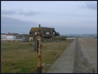 St Marys Bay in Kent lies on the south east coast of the Romney Marsh , between the
villages of Littlestone and Dymchurch. It is a modern 1900's village which
catered for the boom in seaside holidays in the 1920's.
On the 16th July 1927, the Romney Hythe and Dymchurch Railway (RHDR) a narrow gauge railway
was opened, St Marys Bay one of the original stations was called Holiday Camp
then St Mary's Bay until the 1980's when it became Jefferson Lane, finally
back to St Marys Bay in 2000. St Marys Bay in Kent lies on the south east coast of the Romney Marsh , between the
villages of Littlestone and Dymchurch. It is a modern 1900's village which
catered for the boom in seaside holidays in the 1920's.
On the 16th July 1927, the Romney Hythe and Dymchurch Railway (RHDR) a narrow gauge railway
was opened, St Marys Bay one of the original stations was called Holiday Camp
then St Mary's Bay until the 1980's when it became Jefferson Lane, finally
back to St Marys Bay in 2000.
The railway was built by Captain J. E. P. Howey and Count Louis Zborowski to
serve the local population and tourist trade, it stretches for nearly 14 miles
from Hythe through Dymchurch , St Marys Bay ,its base at New Romney ,Romney Sands
and then to the fishermens cottages and lighthouses at Dungeness . It is still
a major tourist attraction and well worth a visit.
(Click here for the Official RHDR site)
Out to sea, lies a section of the Concrete Mulberry Harbour built during 1944
for the Dunkirk landings in the Second World War. This section became detached
from its tug and drifted back to St Marys Bay .
With the advent of package holidays the UK holiday camps have been slowly
shutting down, and St Marys Bay is no exception, its heyday was in the
1960's. |
|
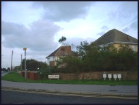
 St Marys Bay in Kent lies on the Dymchurch wall sea defences, and has fine views
to the White Cliffs at Folkestone to the east and to Dungeness to the west. St Marys Bay in Kent lies on the Dymchurch wall sea defences, and has fine views
to the White Cliffs at Folkestone to the east and to Dungeness to the west.
The village is fairly modern and caters for the visitors who come to stay
and take in the sand and sea.
The beach is provides safe bathing for most people with its deep sandy beach
that goes out over 1/2 mile at low tide. |
|
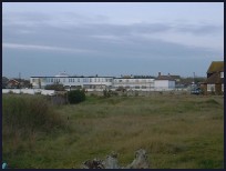
 St Marys Bay in Kent has the usual shops and amusements found at holiday resorts. St Marys Bay in Kent has the usual shops and amusements found at holiday resorts.
The nearest main shops are at Hythe about 4 miles to the east and Folkestone
a further 2 miles. |
|
| St Marys Bay is shown as the red symbol on the map. |
|
|
Nearby Villages
(click on symbol to see the village page) |
| Village= | |
Town= | |
Recorded in Domesday= |  |
| |
|
|
Brenzett |
(St Eanswyth a saxon princess) | | 5.47 miles |
|
|
Brookland |
(13th century wooden spire) | | 6.32 miles |
|
|
Burmarsh |
(The fortress in the Marsh?) | | 2.85 miles |
|
|
Dymchurch |
(The Romans and the sea wall) | | 1.68 miles |
|
|
Greatstone |
(Parabolic Sound Detectors and PLUTO) | | 3.36 miles |
|
|
Ivychurch |
(The burial ground on the Island) | | 3.97 miles |
|
|
Littlestone |
(The Genteel Resort) | | 1.85 miles |
|
|
Lydd |
(The Cathedral of the Marsh) | | 5.10 miles |
|
|
Newchurch |
(The Church Tower with a kink) | | 3.29 miles |
|
|
New Romney |
(Cinque Port and Storm) | | 2.37 miles |
|
|
Old Romney |
(Sheep and Wool Smuggling) | | 3.86 miles |
|
|
Ruckinge |
(Smuggling and Traction Engines) | | 5.60 miles |
|
|
Snargate |
(Sluice Gates made by Royal Order) | | 6.18 miles |
|
|
Snave |
(the Remote church) | | 5.10 miles |
|
|
St Mary in the Marsh |
(Ancient Celts) | | 1.51 miles |
|
|
Warehorne |
(A good place to explore the Marshes) | | 7.03 miles |
|
|


